Technology Overview
Ultra-nearshore underwater bathymetry mapping technology integrates image observation, flow-field analysis, and bathymetry inversion to establish a rapid mapping method for shallow nearshore areas. Through non-contact measurement, the method can obtain terrain information in areas where conventional survey vessels or underwater instruments are difficult to operate, providing efficient and spatially continuous underwater bathymetry data.
This technology can be applied to coastal terrain monitoring, erosion and deposition change analysis, coastal engineering assessment, wave propagation research, and environmental surveys, improving the ability and efficiency of bathymetric data acquisition in ultra-nearshore areas.
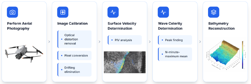
Technical Architecture
The technical architecture covers the main processing workflow, including image data acquisition, velocity information extraction, hydrodynamic analysis, and bathymetry inversion. The system first uses optical imagery to observe sea-surface wave motion features, then applies image analysis to estimate surface velocity and wave information, and combines wave-current theory with inversion algorithms to estimate underwater terrain distribution.
The complete workflow establishes a data chain from observation data to bathymetric results, effectively supporting terrain mapping and long-term monitoring needs in ultra-nearshore areas.
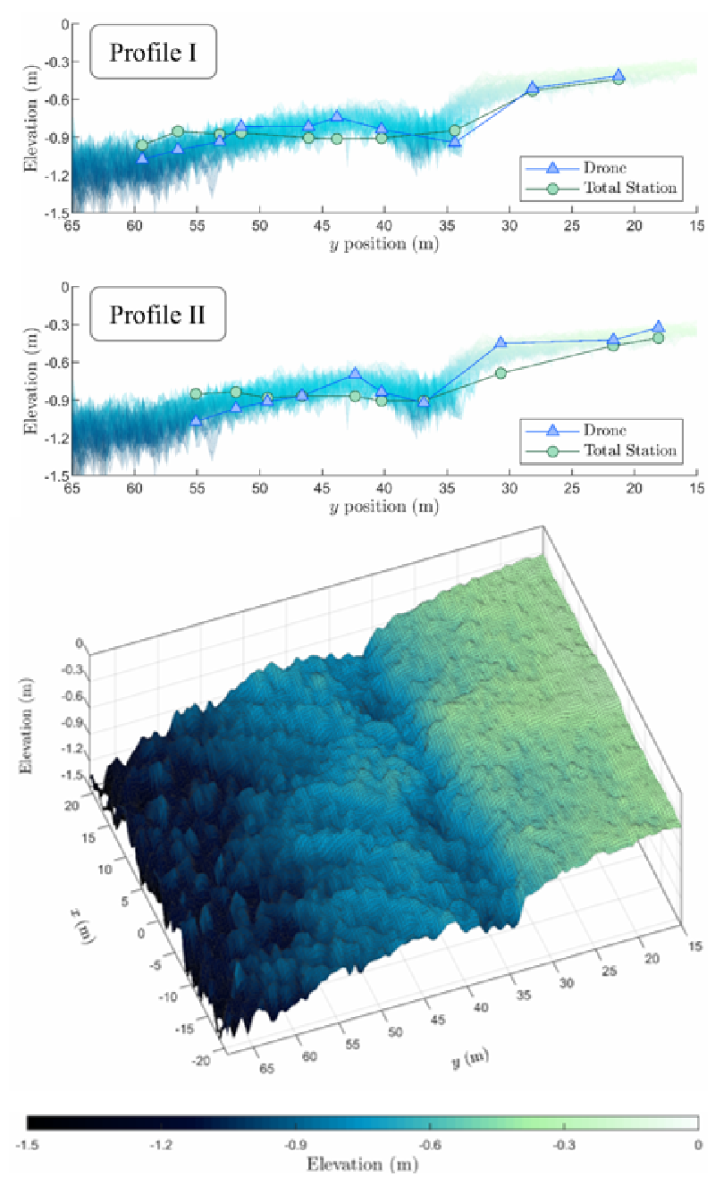
Bathymetry Inversion Results
Bathymetry inversion results display nearshore depth distribution and terrain characteristics, clearly presenting underwater geomorphic information such as sandbars, scour channels, and terrain variations. In addition to serving as bathymetry mapping outputs, the results can provide foundational data for wave numerical simulation, coastal change analysis, and engineering planning.
Through periodic monitoring and result comparison, the method can further support understanding of nearshore terrain evolution trends and environmental change.
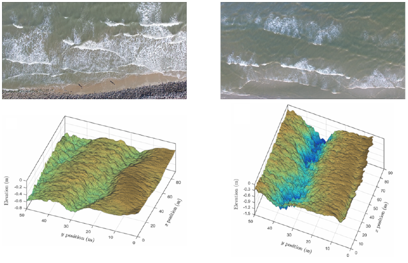
Image and Velocity Overlay
The source image and velocity overlay results demonstrate the integrated use of image observation data and flow-field analysis outputs. By presenting velocity vectors, flow-field distribution, and field imagery together, the results help examine nearshore wave-current dynamics and their relationship with bathymetric distribution.
These outputs can serve as a quality check for bathymetry inversion and also help explain nearshore wave-current mechanisms, improving the reliability and application value of inversion results.